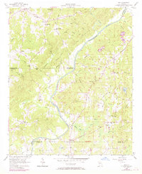
1958 Map of Rico
USGS Topo · Published 1969About this map
The Chattahoochee River carves a deep diagonal through this landscape, marking the historic boundary between Douglas, Carroll, and Fulton counties. During the late 1950s, the region remained primarily rural, defined by small settlements like Rico and Fairplay and a network of country roads such as the Campbellton-Redwine Road. The map reveals a community-centric topography where local identity was tied to landmarks like Fairplay Sch and numerous churches, including Ebenezer Ch and Flint Hill Ch.
Find a feature on this map
54 named features on this map. Tap any name to fly to it.
Don’t see what you’re looking for? This feature index may not catch every label — zoom into the map to look around manually.
Map Details
Editions of this 1958 Rico Map
Other maps of this area

1891 · Marietta
USGS Topo · 1:125,000

1895 · Marietta
USGS Topo · 1:125,000

1897 · Marietta
USGS Topo · 1:125,000

1901 · Marietta
USGS Topo · 1:125,000

1953 · Atlanta
USGS Topo · 1:250,000

1954 · Palmetto
USGS Topo · 1:24,000

1954 · Campbellton
USGS Topo · 1:24,000

1957 · Atlanta
USGS Topo · 1:250,000

1958 · Rico
USGS Topo · 1:24,000

1958 · Atlanta
USGS Topo · 1:250,000