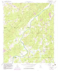
1958 Map of Rico
USGS Topo · Published 1983About this map
The Chattahoochee River carves a deep path through this Georgia landscape, serving as the primary geographic divider between Fulton, Douglas, and Carroll counties. The area is defined by a dense network of country churches that anchored rural life in the mid-20th century, including Fairfield Ch, Macedonia Ch, and Sardis Ch. Small agrarian settlements like Fairplay and Rico are connected by a web of named roads such as Campbellton-Redwine Road and Nimrod Morris Road, tracing the old transportation routes of the Piedmont region.
Find a feature on this map
60 named features on this map. Tap any name to fly to it.
Don’t see what you’re looking for? This feature index may not catch every label — zoom into the map to look around manually.
Map Details
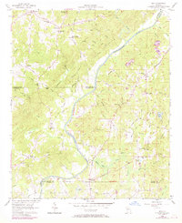
Editions of this 1958 Rico Map
Other maps of this area

1891 · Marietta
USGS Topo · 1:125,000

1895 · Marietta
USGS Topo · 1:125,000

1897 · Marietta
USGS Topo · 1:125,000

1901 · Marietta
USGS Topo · 1:125,000

1953 · Atlanta
USGS Topo · 1:250,000

1954 · Palmetto
USGS Topo · 1:24,000

1954 · Campbellton
USGS Topo · 1:24,000

1957 · Atlanta
USGS Topo · 1:250,000

1958 · Rico
USGS Topo · 1:24,000

1958 · Atlanta
USGS Topo · 1:250,000