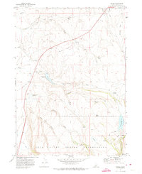
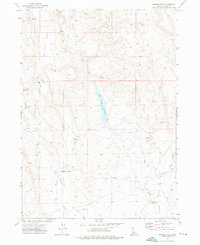
1971 Map of Riddle
USGS Topo · Published 1974About this map
Duck Valley Indian Reservation dominates the southern reaches of this high-plateau landscape, where the Idaho-Nevada border country is defined by isolated ranching outposts and a network of seasonal water sources. The settlement of Riddle serves as a central point for the surrounding region, situated near a vital Landing Strip and the Squaw Creek Reservoir. The terrain transitions from the broad expanses of Summit Flat and Chicken Flat in the north to the deeply incised Old Man Canyon and the prominent rising of Moorcastle in the center. Evidence of earlier habitation or ranching infrastructure appears at the Ruins near Indian Creek Reservoir, while the presence of several Borrow Pits suggests localized road maintenance or construction efforts within this arid environment. Ranching heritage is anchored by the U D Ranch, positioned along the drainage of Payne Creek as it winds through the northern hills.
Find a feature on this map
42 named features on this map. Tap any name to fly to it.
Don’t see what you’re looking for? This feature index may not catch every label — zoom into the map to look around manually.
Map Details
Editions of this 1971 Riddle Map
This is the sole edition of this map. No revisions or reprints were ever made.
Other maps of this area

1955 · Jordan Valley
USGS Topo · 1:250,000

1955 · Twin Falls
USGS Topo · 1:250,000

1957 · Jordan Valley
USGS Topo · 1:250,000

1958 · Twin Falls
USGS Topo · 1:250,000

1958 · Jordan Valley
USGS Topo · 1:250,000
1971 · Flying H Ranch
USGS Topo · 1:24,000
1971 · Three Forks
USGS Topo · 1:24,000
1971 · Mountain View Lake
USGS Topo · 1:24,000

1972 · Little Blue Table
USGS Topo · 1:24,000
1972 · Nichol Flat
USGS Topo · 1:24,000