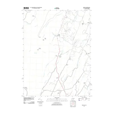
2011 Map of Ridge
USGS Topo · Published 2011About this map
Cacapon Mountain High Point anchors the western ridge of this terrain, where the landscape is defined by the narrow, parallel valleys of Sleepy Creek and its many tributaries. The area around Ridge serves as a local hub, featuring the Ridge State Fish Hatchery and proximity to Sink Pond Hollow. This 2011 survey captures the distribution of rural life along historic corridors like the Morgan Frederick Grade and the Cumberland Trail Rd, illustrating how settlements like Hinckle and Unger remained tied to these winding mountain passages. Local history is preserved at the Union Cemetery near the northern boundary and Salem Cemetery further south, while the Unger Post Office and Bloomery Post Office mark the enduring civic centers of these small communities. The presence of Camp Win-Wah and the numerous named ridges, such as Dick Ridge and Piney Ridge, underscores the region's character as a managed wilderness and agricultural woodland.
Find a feature on this map
70 named features on this map. Tap any name to fly to it.
Don’t see what you’re looking for? This feature index may not catch every label — zoom into the map to look around manually.
Map Details
Editions of this 2011 Ridge Map
This is the sole edition of this map. No revisions or reprints were ever made.
Other maps of this area

1894 · Winchester
USGS Topo · 1:125,000

1898 · Paw Paw
USGS Topo · 1:62,500

1899 · Hancock
USGS Topo · 1:62,500

1900 · Pawpaw
USGS Topo · 1:62,500

1901 · Hancock
USGS Topo · 1:62,500

1910 · Paw Paw
USGS Topo · 1:62,500

1914 · Gerrardstown
USGS Topo · 1:48,000

1916 · Gerrardstown
USGS Topo · 1:62,500

1916 · Capon Bridge
USGS Topo · 1:62,500

1923 · Capon Bridge
USGS Topo · 1:62,500