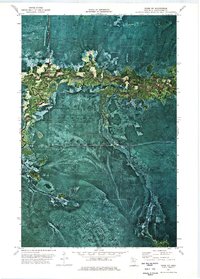
1973 Map of Ridge NE
USGS Topo · Published 1976About this map
Pine Island State Forest dominates this northern Minnesota landscape, captured during a 1973 field check of 1969 aerial photography. The terrain is defined by its extensive wetland and timber character, where the Sturgeon River and Dinner Creek wind through dense woodland. This orthophotomap provides a rare visual of the vegetation patterns and seasonal access routes used by foresters and hunters in the early 1970s. Evidence of human presence is sparse, concentrated at Gates Camp and along the established path of Pine Island Road. A network of seasonal Winter Trails crisscrosses the township lines, illustrating how the remote Koochiching County wilderness was navigated when the frozen ground permitted travel through the saturated lowlands.
Find a feature on this map
6 named features on this map. Tap any name to fly to it.
Don’t see what you’re looking for? This feature index may not catch every label — zoom into the map to look around manually.
Map Details
Editions of this 1973 Ridge NE Map
This is the sole edition of this map. No revisions or reprints were ever made.
Other maps of this area

1919 · Lundgren
USGS Topo · 1:62,500

1919 · I
USGS Topo · 1:62,500

1919 · Margie
USGS Topo · 1:62,500

1943 · Lindford
USGS Topo · 1:62,500

1954 · Roseau
USGS Topo · 1:250,000

1954 · International Falls
USGS Topo · 1:250,000

1957 · Roseau
USGS Topo · 1:250,000

1957 · International Falls
USGS Topo · 1:250,000

1958 · International Falls
USGS Topo · 1:250,000

1958 · Roseau
USGS Topo · 1:250,000