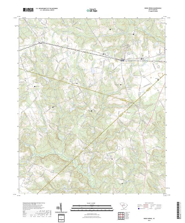
2024 Map of Ridge Spring
USGS Topo · Published 2024About this map
The town of Ridge Spring and the settlement of Ward anchor this landscape along the border of Saluda and Edgefield counties. The area is defined by a dense network of family-named ponds and small watercourses, including J C Watson Pond, Boatwrights Pond, and Sanders Pond, which feed into larger systems like the South Fork Edisto River. Local genealogy is particularly well-represented through numerous small burial sites such as Raiford Cem, Morris Cem, and Herrin Cem, alongside the Ridge Hill Church Graveyard. The terrain is marked by an intricate system of rural roads and branches, including Bog Branch and Beech Creek, illustrating a long-established agricultural and homesteading pattern. Significant landmarks like Vonce Millpond and Ridgeview Lake further highlight the historical reliance on local water resources for both industry and community life in this portion of South Carolina.
Find a feature on this map
126 named features on this map. Tap any name to fly to it.
Don’t see what you’re looking for? This feature index may not catch every label — zoom into the map to look around manually.
Map Details
Editions of this 2024 Ridge Spring Map
This is the sole edition of this map. No revisions or reprints were ever made.
Other maps of this area

1920 · Aiken
USGS Topo · 1:48,000

1921 · Aiken
USGS Topo · 1:62,500

1923 · Warrenville
USGS Topo · 1:48,000

1928 · Warrenville
USGS Topo · 1:62,500

1943 · Aiken
USGS Topo · 1:62,500

1943 · Warrenville
USGS Topo · 1:62,500

1954 · Augusta
USGS Topo · 1:250,000

1957 · Augusta
USGS Topo · 1:250,000

1958 · Augusta
USGS Topo · 1:250,000

1961 · Augusta
USGS Topo · 1:250,000