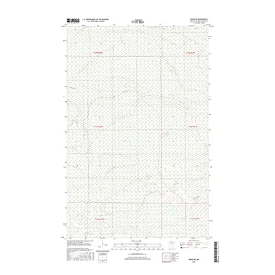
2016 Map of Ridge SW
USGS Topo · Published 2016About this map
Lost River meanders across this northern Minnesota landscape, defining the hydrology of a region dominated by extensive wetland systems. The terrain is largely defined by its township and range divisions, specifically within t153n r28w and t153n r27w, where the low-lying basin of the river dictates the limited transportation network. Human activity is concentrated along the few established corridors such as Lost River Rd in the northwest and Gemmell Ridge Rd in the southeast. This 2016 survey illustrates a largely undeveloped expanse of Koochiching County, where the intricate patterns of the Lost River and its surrounding marshlands remain the primary geographic features.
Find a feature on this map
9 named features on this map. Tap any name to fly to it.
Don’t see what you’re looking for? This feature index may not catch every label — zoom into the map to look around manually.
Map Details
Editions of this 2016 Ridge SW Map
This is the sole edition of this map. No revisions or reprints were ever made.
Other maps of this area

1919 · Lundgren
USGS Topo · 1:62,500

1919 · Gemmell
USGS Topo · 1:62,500

1919 · Norden
USGS Topo · 1:62,500

1919 · Bridgie
USGS Topo · 1:62,500

1924 · Bridgie
USGS Topo · 1:62,500

1954 · Bemidji
USGS Topo · 1:250,000

1954 · Roseau
USGS Topo · 1:250,000

1957 · Roseau
USGS Topo · 1:250,000

1957 · Bemidji
USGS Topo · 1:250,000

1958 · Bemidji
USGS Topo · 1:250,000