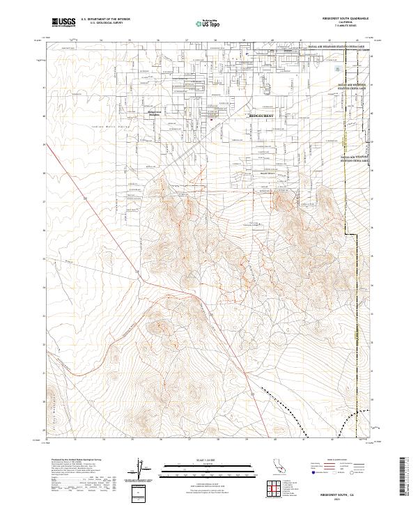
2021 Map of Ridgecrest South
USGS Topo · Published 2021About this map
Ridgecrest serves as the primary hub of activity in this desert landscape, where the residential grids of Ridgecrest Heights and the central township meet the expansive reaches of the Indian Wells Valley. The map shows a clear division between the organized street networks of the north and the rising elevation of the Rademacher Hill area to the south. Modern educational infrastructure is anchored by the Cerro Coso Community College campus, situated at the edge of the more densely settled areas. Beyond the suburbs, the terrain shifts into the higher ground of the El Paso Mountains and the arid expanse of the Mojave Desert. The layout of the roads, such as Bowman Rd and Ridgecrest Blvd, highlights the community's orientation toward the surrounding valley floor and its position near the boundary of Kern and San Bernardino Counties.
Find a feature on this map
137 named features on this map. Tap any name to fly to it.
Don’t see what you’re looking for? This feature index may not catch every label — zoom into the map to look around manually.
Map Details
Editions of this 2021 Ridgecrest South Map
This is the sole edition of this map. No revisions or reprints were ever made.
Other maps of this area

1903 · Randsburg
USGS Topo · 1:62,500

1911 · Randsburg
USGS Topo · 1:62,500

1912 · Randsburg
USGS Topo · 1:62,500

1915 · Searles Lake
USGS Topo · 1:250,000

1943 · Inyokern
USGS Topo · 1:62,500

1943 · Saltdale
USGS Topo · 1:62,500

1947 · Trona
USGS Topo · 1:250,000

1948 · Trona
USGS Topo · 1:250,000

1953 · Ridgecrest
USGS Topo · 1:62,500

1953 · Trona
USGS Topo · 1:250,000