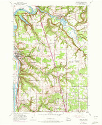
1954 Map of Ridgefield
USGS Topo · Published 1972About this map
Lewis River and its East Fork define the northern and western margins of this landscape, where the waters of Mud Lake and Campbell Lake lie within the floodplains. The settlement at Ridgefield sits prominently above the river, served by the Union Pacific and Burlington Northern railroads. Further inland, the small community of La Center and the hamlet of Sara are connected by a network of rural roads like Pioneer Road and Pekin Ferry Road.
Find a feature on this map
54 named features on this map. Tap any name to fly to it.
Don’t see what you’re looking for? This feature index may not catch every label — zoom into the map to look around manually.
Map Details
Editions of this 1954 Ridgefield Map
3 editions found
Other maps of this area

1897 · Portland
USGS Topo · 1:62,500

1905 · Portland
USGS Topo · 1:62,500

1915 · Hillsboro
USGS Topo · 1:62,500

1918 · Hillsboro
USGS Topo · 1:62,500

1922 · St. Helens
USGS Topo · 1:62,500

1940 · Hillsboro
USGS Topo · 1:62,500

1940 · Portland
USGS Topo · 1:62,500

1940 · La Center
USGS Topo · 1:62,500

1941 · St Helens
USGS Topo · 1:62,500

1943 · St Helens
USGS Topo · 1:62,500