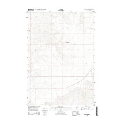
2015 Map of Ridgeview SW
USGS Topo · Published 2015About this map
The settlement of Thatcher lies in a landscape defined by seasonal drainages and local prairie infrastructure on this 2015 survey of central South Dakota. The terrain is marked by the meandering path of Goose Cr in the northern reaches, while the southern portion features the headwaters of W Br Rousseau Cr and Fox Cr. This area represents a transition between open rangeland and the structured township and range system, evident in the grid-like pattern of local roads including Cr-158 and Cr-15. Bureau of Indian Affairs route Bia-19 cuts across the southwestern corner, reflecting the importance of transportation networks for local residents and land management. The map serves as a contemporary record of rural life, where small named communities and essential water sources define the geography.
Find a feature on this map
13 named features on this map. Tap any name to fly to it.
Don’t see what you’re looking for? This feature index may not catch every label — zoom into the map to look around manually.
Map Details
Editions of this 2015 Ridgeview SW Map
This is the sole edition of this map. No revisions or reprints were ever made.
Other maps of this area

1951 · Ridgeview NW
USGS Topo · 1:24,000

1951 · Ridgeview NE
USGS Topo · 1:24,000

1952 · Parade NE
USGS Topo · 1:24,000

1953 · McIntosh
USGS Topo · 1:250,000

1954 · Pierre
USGS Topo · 1:250,000

1958 · Pierre
USGS Topo · 1:250,000

1958 · McIntosh
USGS Topo · 1:250,000

1981 · Charlie Creek
USGS Topo · 1:24,000

1981 · Rousseau Creek NW
USGS Topo · 1:24,000

1981 · Herbert Creek NE
USGS Topo · 1:24,000