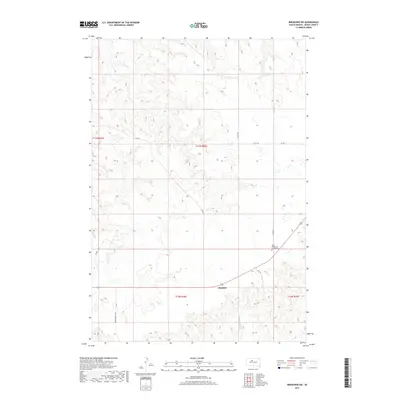
2017 Map of Ridgeview SW
USGS Topo · Published 2017About this map
Saint Basils Cem at Mossman stands as a significant historical marker within the Dewey County landscape, situated just north of the intersection of Highway 212 and Co RD 15. This 2017 survey reveals the quiet, rural character of the region near Thatcher, where a network of county roads like Armstrong Co Rd and 255 Ave connect scattered homesteads and agricultural land. The terrain is defined by its subtle drainage patterns, with the headwaters of Goose Cr and the W Br Rousseau Cr carving into the upland plains. The inclusion of Phil St near the eastern boundary suggests localized settlement patterns or family landholdings, providing a modern record of the local infrastructure in this part of South Dakota. For those studying the genealogy of the area, the cemetery at Mossman serves as a primary point of reference in an otherwise sparsely populated prairie environment.
Find a feature on this map
17 named features on this map. Tap any name to fly to it.
Don’t see what you’re looking for? This feature index may not catch every label — zoom into the map to look around manually.
Map Details
Editions of this 2017 Ridgeview SW Map
This is the sole edition of this map. No revisions or reprints were ever made.
Other maps of this area

1951 · Ridgeview NW
USGS Topo · 1:24,000

1951 · Ridgeview NE
USGS Topo · 1:24,000

1952 · Parade NE
USGS Topo · 1:24,000

1953 · McIntosh
USGS Topo · 1:250,000

1954 · Pierre
USGS Topo · 1:250,000

1958 · Pierre
USGS Topo · 1:250,000

1958 · McIntosh
USGS Topo · 1:250,000

1981 · Charlie Creek
USGS Topo · 1:24,000

1981 · Rousseau Creek NW
USGS Topo · 1:24,000

1981 · Herbert Creek NE
USGS Topo · 1:24,000