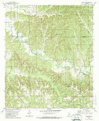
1981 Map of Ridgeville
USGS Topo · Published 1987About this map
The tri-county intersection of Wilcox, Lowndes, and Butler counties defines this rural Alabama landscape. Settlement is concentrated along the ridges, notably at Ridgeville and Macedonia, where the upland terrain provides relief from the dense drainage networks of Cedar Creek and Wolf Creek. The map documents a deeply traditional community structure centered on small rural institutions such as Oak Valley Ch and Mt Olive Ch, along with family and community burial grounds like Snow Cem and Crenshaw Cem. While much of the area is dominated by forested creek bottoms and hills like County Line Hill, the presence of a Gravel Pit indicates local small-scale resource extraction. This survey preserves the exact locations of these local landmarks and the winding rural road network as it existed in the early 1980s.
Find a feature on this map
21 named features on this map. Tap any name to fly to it.
Don’t see what you’re looking for? This feature index may not catch every label — zoom into the map to look around manually.
Map Details
Editions of this 1981 Ridgeville Map
2 editions found
Other maps of this area

1953 · Montgomery
USGS Topo · 1:250,000

1953 · Andalusia
USGS Topo · 1:250,000

1956 · Montgomery
USGS Topo · 1:250,000

1957 · Montgomery
USGS Topo · 1:250,000

1957 · Andalusia
USGS Topo · 1:250,000

1957 · Braggs
USGS Topo · 1:62,500

1971 · Greenville West
USGS Topo · 1:24,000

1971 · Fort Dale
USGS Topo · 1:24,000

1981 · Pine Apple North
USGS Topo · 1:24,000
1981 · Mount Willing
USGS Topo · 1:24,000