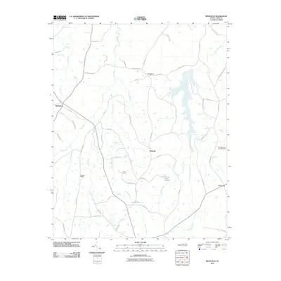
2010 Map of Ridgeville
USGS Topo · Published 2010About this map
Hyco Creek and its many tributaries, including South Hyco Creek and Panther Branch, define the rural geography of this portion of Caswell County. The landscape is dotted with small crossroads communities like Ridgeville, Frogsboro, and Gordonton, reflecting a traditional Piedmont settlement pattern of scattered hamlets connected by winding country roads. For local historians, the inclusion of Cooper Cemetery and the Salem Methodist Church and its accompanying Salem Methodist Cemetery provides essential markers of the area's social and genealogical heritage.
Find a feature on this map
56 named features on this map. Tap any name to fly to it.
Don’t see what you’re looking for? This feature index may not catch every label — zoom into the map to look around manually.
Map Details
Editions of this 2010 Ridgeville Map
This is the sole edition of this map. No revisions or reprints were ever made.
Other maps of this area

1953 · Greensboro
USGS Topo · 1:250,000

1954 · Greensboro
USGS Topo · 1:250,000

1962 · Greensboro
USGS Topo · 1:250,000

1966 · Greensboro
USGS Topo · 1:250,000

1967 · Cedar Grove
USGS Topo · 1:24,000

1968 · Leasburg
USGS Topo · 1:24,000

1968 · Caldwell
USGS Topo · 1:24,000

1968 · Ridgeville
USGS Topo · 1:24,000

1968 · Hurdle Mills
USGS Topo · 1:24,000
1968 · Olive Hill
USGS Topo · 1:24,000