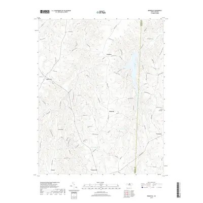
2019 Map of Ridgeville
USGS Topo · Published 2019About this map
Ridgeville and the surrounding Piedmont landscape of Caswell and Person Counties are defined by a network of creeks and small family-named settlements. The hydrology of the region is centered on South Hyco Creek and its many tributaries, including Sugartree Cr, Coneys Cr, and the curious Negro Cr. These waterways dictate the winding paths of local roads such as Hickory Flats Rd and Roxboro Lake Rd.
Find a feature on this map
84 named features on this map. Tap any name to fly to it.
Don’t see what you’re looking for? This feature index may not catch every label — zoom into the map to look around manually.
Map Details
Editions of this 2019 Ridgeville Map
This is the sole edition of this map. No revisions or reprints were ever made.
Other maps of this area

1953 · Greensboro
USGS Topo · 1:250,000

1954 · Greensboro
USGS Topo · 1:250,000

1962 · Greensboro
USGS Topo · 1:250,000

1966 · Greensboro
USGS Topo · 1:250,000

1967 · Cedar Grove
USGS Topo · 1:24,000

1968 · Leasburg
USGS Topo · 1:24,000

1968 · Caldwell
USGS Topo · 1:24,000

1968 · Ridgeville
USGS Topo · 1:24,000

1968 · Hurdle Mills
USGS Topo · 1:24,000
1968 · Olive Hill
USGS Topo · 1:24,000