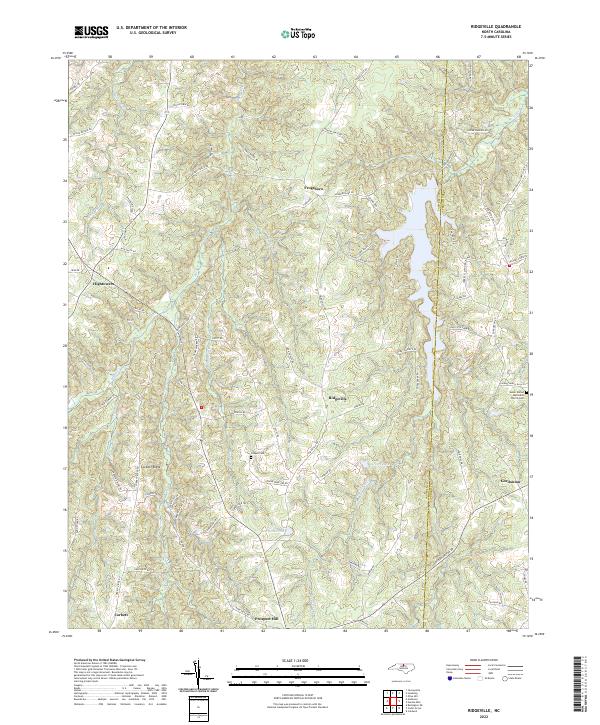
2022 Map of Ridgeville
USGS Topo · Published 2022About this map
The northern reaches of the Caswell and Person County line are defined here by the winding waters of Hyco Creek and its many tributaries, including Sugartree Creek and Panther Branch. This 2022 survey reveals a landscape characterized by small crossroads settlements like Frogsboro, Ridgeville, and Gordonton, connected by a network of rural routes often named for the families that established them. Long-standing local landmarks such as the Salem United Methodist Church Cem and Cooper Cemetery offer vital reference points for genealogists tracing ancestral roots in this Piedmont region. The map also documents significant local water bodies like Carvers Lake and Morgans Pond, which punctuate the rolling terrain near Corbett Ridge and Prospect Hill.
Find a feature on this map
76 named features on this map. Tap any name to fly to it.
Don’t see what you’re looking for? This feature index may not catch every label — zoom into the map to look around manually.
Map Details
Editions of this 2022 Ridgeville Map
This is the sole edition of this map. No revisions or reprints were ever made.
Other maps of this area

1953 · Greensboro
USGS Topo · 1:250,000

1954 · Greensboro
USGS Topo · 1:250,000

1962 · Greensboro
USGS Topo · 1:250,000

1966 · Greensboro
USGS Topo · 1:250,000

1967 · Cedar Grove
USGS Topo · 1:24,000

1968 · Leasburg
USGS Topo · 1:24,000

1968 · Caldwell
USGS Topo · 1:24,000

1968 · Ridgeville
USGS Topo · 1:24,000

1968 · Hurdle Mills
USGS Topo · 1:24,000
1968 · Olive Hill
USGS Topo · 1:24,000