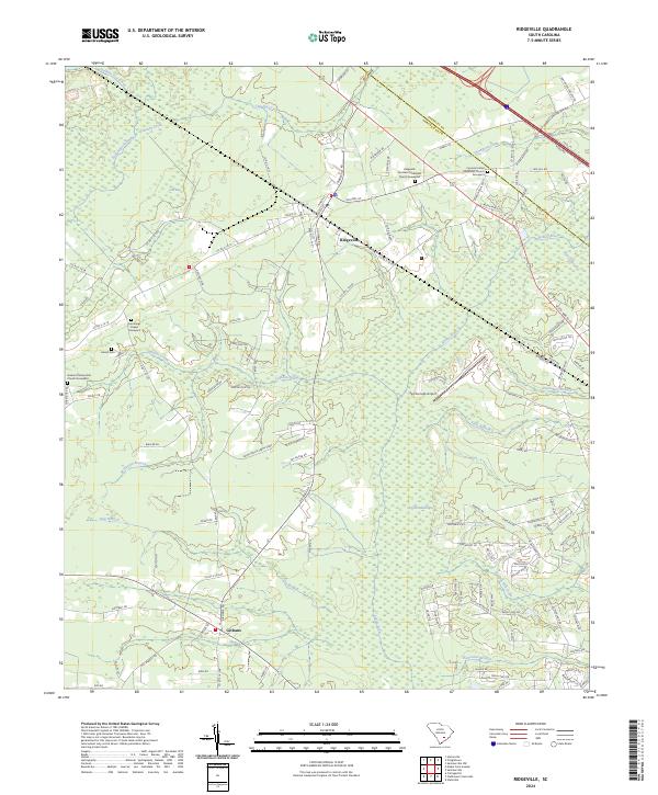
2024 Map of Ridgeville
USGS Topo · Published 2024About this map
Ridgeville and Givhans anchor this corner of the South Carolina Lowcountry, where the landscape is defined by the slow-moving waters of Four Hole Swamp and the Ashley River. The area's genealogical history is well-preserved through several dedicated burial grounds, including the Ridgeville Southern Methodist Church Graveyard and the Cummings Chapel Graveyard. This map provides a contemporary view of the intersection between established rural settlements and the vast natural drainages like Cypress Swamp and Halfway Gut Creek. Transportation and infrastructure are represented by the Summerville Airport and a dense network of country roads such as Wagon Trail Rd, illustrating the modern balance of suburban expansion and agricultural roots in Dorchester and Berkeley counties.
Find a feature on this map
130 named features on this map. Tap any name to fly to it.
Don’t see what you’re looking for? This feature index may not catch every label — zoom into the map to look around manually.
Map Details
Editions of this 2024 Ridgeville Map
This is the sole edition of this map. No revisions or reprints were ever made.
Other maps of this area

1918 · Cottageville
USGS Topo · 1:62,500

1919 · Summerville
USGS Topo · 1:48,000

1919 · Ridgeville
USGS Topo · 1:48,000

1920 · Ravenels
USGS Topo · 1:62,500

1920 · Ridgeville
USGS Topo · 1:62,500

1920 · Summerville
USGS Topo · 1:62,500

1943 · Cottageville
USGS Topo · 1:62,500

1943 · Ridgeville
USGS Topo · 1:62,500

1944 · Ravenels
USGS Topo · 1:62,500

1944 · Summerville
USGS Topo · 1:62,500