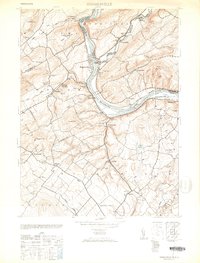
1953 Map of Riegelsville
USGS Topo · Published 1953About this map
Riegelsville sits at the dramatic confluence of the Delaware River and the Musconetcong River, a landscape defined by the industrial and transport arteries of the early 1950s. The Pennsylvania Canal parallels the river, a remnant of an earlier era of commerce, while the Belvidere Div railroad and the Durham Paper Co demonstrate the ongoing industrial character of the valley. Small settlements like Durham Furnace and Finesville are anchored by local institutions, including the Durham School and the Christian Church.
Find a feature on this map
69 named features on this map. Tap any name to fly to it.
Don’t see what you’re looking for? This feature index may not catch every label — zoom into the map to look around manually.
Map Details
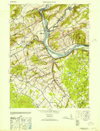
Editions of this 1953 Riegelsville Map
2 editions found
Other maps of this area

1888 · Quakertown
USGS Topo · 1:62,500

1890 · Easton
USGS Topo · 1:62,500

1890 · Doylestown
USGS Topo · 1:62,500

1890 · Quakertown
USGS Topo · 1:62,500

1891 · Easton
USGS Topo · 1:62,500

1891 · Doylestown
USGS Topo · 1:62,500

1894 · Allentown
USGS Topo · 1:62,500

1894 · Quakertown
USGS Topo · 1:62,500

1932 · Easton
USGS Topo · 1:62,500

1939 · Allentown
USGS Topo · 1:62,500