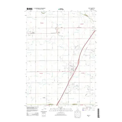
2013 Map of Rigby
USGS Topo · Published 2013About this map
The Snake River defines the northern reaches of this Jefferson County landscape, where an intricate web of historic water management infrastructure supports the high desert agriculture of the upper Snake River Plain. Centered on the city of Rigby, the map details a sophisticated network of canals and sloughs, including the Parks Lewisville Canal and the Annis Slough. These waterways follow the natural topography, winding through the valley between the Little Buttes and the outlying settlements of Menan, Annis, and Lorenzo. The transport and irrigation patterns shown here reflect decades of local engineering, with named features like the Selck and Taylor Canal and Vance Payne Canal illustrating the division of water rights that shaped the development of Garfield and the surrounding townships. Modern infrastructure is also represented by the Rigby-Jefferson County Airport, positioned near the junction of major irrigation arteries.
Find a feature on this map
161 named features on this map. Tap any name to fly to it.
Don’t see what you’re looking for? This feature index may not catch every label — zoom into the map to look around manually.
Map Details
Editions of this 2013 Rigby Map
This is the sole edition of this map. No revisions or reprints were ever made.
Other maps of this area

1948 · Rigby
USGS Topo · 1:24,000

1948 · Lewisville
USGS Topo · 1:24,000

1948 · Idaho Falls North
USGS Topo · 1:24,000

1948 · Ucon
USGS Topo · 1:24,000

1949 · Ucon
USGS Topo · 1:24,000

1949 · Idaho Falls North
USGS Topo · 1:24,000

1949 · Rexburg
USGS Topo · 1:24,000

1949 · Rigby
USGS Topo · 1:24,000

1949 · Lewisville
USGS Topo · 1:24,000

1949 · Roberts
USGS Topo · 1:62,500