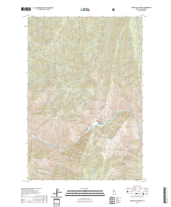
2024 Map of Riggins Hot Springs
USGS Topo · Published 2024About this map
The Salmon River cuts a deep path through this portion of the Nez Perce National Forest, where the settlement of Riggins Hot Springs sits along the northern riverbank. This 2024 survey documents a landscape of dramatic elevation changes and named high points such as Berg Mtn, Padrick Ridge, and Keating Ridge. The river corridor itself features localized alluvial flats like Music Bar and the Spring Bar recreation site, accessible via Salmon River Rd. Further south, Warm Springs Point overlooks the drainage of Warm Springs Creek, while the northern portion of the quadrangle is defined by steep creek canyons and remote saddles like Deep Saddle and Plant Saddle. The map provides a current view of the Forest Service road network, including the Natl Forest Develop Road 263 Rd, which traverses the high ground above Rooney Basin.
Find a feature on this map
41 named features on this map. Tap any name to fly to it.
Don’t see what you’re looking for? This feature index may not catch every label — zoom into the map to look around manually.
Map Details
Editions of this 2024 Riggins Hot Springs Map
This is the sole edition of this map. No revisions or reprints were ever made.
Other maps of this area

1938 · Riggins
USGS Topo · 1:96,000

1945 · Riggins
USGS Topo · 1:125,000

1955 · Grangeville
USGS Topo · 1:250,000

1959 · Grangeville
USGS Topo · 1:250,000

1963 · John Day Mtn
USGS Topo · 1:24,000

1963 · Lucile
USGS Topo · 1:24,000

1963 · Hershey Point
USGS Topo · 1:24,000
1963 · Florence
USGS Topo · 1:24,000
1964 · Patrick Butte
USGS Topo · 1:24,000

1964 · Riggins
USGS Topo · 1:24,000