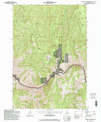
1995 Map of Riggins Hot Springs
USGS Topo · Published 1999About this map
Riggins Hot Springs anchors this mid-1990s survey of the canyon country where the Salmon River cuts through the western edge of the Nez Perce National Forest. The map documents a landscape defined by sharp elevation shifts between the riverbank and high lookouts like Chair Point and Berg Mountain. Human imprints are concentrated along the river corridor, including the Partridge Creek Bridge and isolated sites such as Klepe Place and Hinkley Cabin. Small-scale resource extraction is evident in several prospect locations and a mine near the river's bend. The terrain is marked by prominent landforms like Padrick Ridge and Keating Ridge, with the river’s force highlighted at Ruby Rapids. This edition reflects the Forest Service's detailed management of the Salmon River Ranger District, balancing remote wilderness and localized settlement.
Find a feature on this map
36 named features on this map. Tap any name to fly to it.
Don’t see what you’re looking for? This feature index may not catch every label — zoom into the map to look around manually.
Map Details
Editions of this 1995 Riggins Hot Springs Map
This is the sole edition of this map. No revisions or reprints were ever made.
Other maps of this area

1938 · Riggins
USGS Topo · 1:96,000

1945 · Riggins
USGS Topo · 1:125,000

1955 · Grangeville
USGS Topo · 1:250,000

1959 · Grangeville
USGS Topo · 1:250,000

1963 · John Day Mtn
USGS Topo · 1:24,000

1963 · Lucile
USGS Topo · 1:24,000

1963 · Hershey Point
USGS Topo · 1:24,000
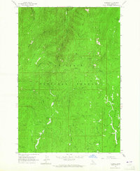
1963 · Florence
USGS Topo · 1:24,000
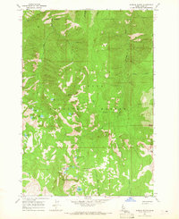
1964 · Patrick Butte
USGS Topo · 1:24,000

1964 · Riggins
USGS Topo · 1:24,000