
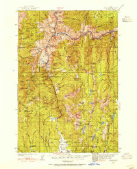
1938 Map of Riggins
USGS Topo · Published 1938About this map
The Salmon River carves through the heart of this Idaho landscape, where the settlement of Riggins serves as a primary hub for the surrounding wilderness of the Nez Perce National Forest. Surveyed in the late 1930s, the map documents a transition from pioneer mountain living to an established forest management and mining economy. Administrative outposts like the Silver Ranger Station and Price Valley Ranger Station are scattered across the high ridges, while industrial activity is represented by the American Rand Mines Co and Yakima Mine. Along the river and its many tributaries, small communities and isolated homesteads such as Shorts Bar, The Crevice, and Goff are linked by the Manning Bridge. The map also reveals specialized rural infrastructure, including the Middle District School, the Circle C Ranch, and a remote Landing Field near Elk Creek, illustrating how early residents navigated this vertical terrain.
Find a feature on this map
181 named features on this map. Tap any name to fly to it.
Don’t see what you’re looking for? This feature index may not catch every label — zoom into the map to look around manually.
Map Details
Editions of this 1938 Riggins Map
2 editions found
Other maps of this area

1911 · Meadows
USGS Topo · 1:125,000

1920 · Seven Devils Mining District
USGS Topo · 1:48,000

1922 · He Devil
USGS Topo · 1:48,000

1931 · Buffalo Hump
USGS Topo · 1:125,000

1934 · Buffalo Hump
USGS Topo · 1:125,000

1945 · Riggins
USGS Topo · 1:125,000

1954 · New Meadows
USGS Topo · 1:62,500

1954 · Kernan Point
USGS Topo · 1:62,500

1955 · Baker
USGS Topo · 1:250,000

1955 · Grangeville
USGS Topo · 1:250,000