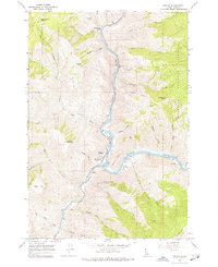
1964 Map of Riggins
USGS Topo · Published 1977About this map
Riggins sits at the dramatic confluence where the Little Salmon River meets the larger Salmon River, serving as a vital hub within the Nezperce National Forest. The 1964 field check reveals a community centered around the river and its canyon, including the Salmon River High Sch and a Gaging Station monitoring the powerful currents. The surrounding terrain is marked by family and character-named landmarks like Preacher Mountain, Whiskey Butte, and Schoolmarm Peak. Navigation along the river is dictated by river miles and obstacles such as the Fiddle Creek Rapids, while the upland areas consist of high flats and saddles like Garrison Flat and Bean Creek Saddle. Numerous drainage systems including South Fork Race Creek and Lightning Creek carve through the landscape, defining the complex topography of this river canyon region.
Find a feature on this map
43 named features on this map. Tap any name to fly to it.
Don’t see what you’re looking for? This feature index may not catch every label — zoom into the map to look around manually.
Map Details
Editions of this 1964 Riggins Map
2 editions found
Other maps of this area

1938 · Riggins
USGS Topo · 1:96,000

1945 · Riggins
USGS Topo · 1:125,000

1955 · Grangeville
USGS Topo · 1:250,000

1959 · Grangeville
USGS Topo · 1:250,000

1963 · John Day Mtn
USGS Topo · 1:24,000

1963 · Lucile
USGS Topo · 1:24,000

1963 · Kirkwood Creek
USGS Topo · 1:24,000
1964 · Patrick Butte
USGS Topo · 1:24,000

1964 · Riggins
USGS Topo · 1:24,000
1964 · Pollock
USGS Topo · 1:24,000