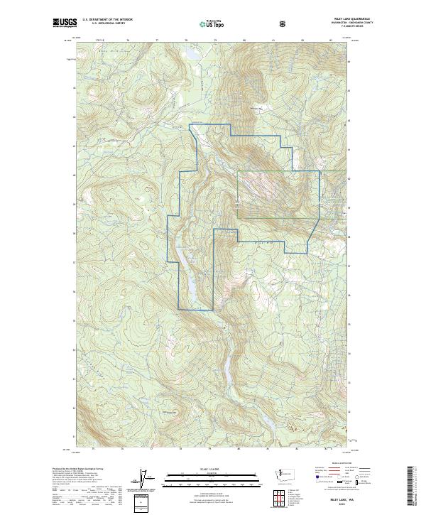
2023 Map of Riley Lake
USGS Topo · Published 2023About this map
Mount Baker National Forest occupies the eastern portion of this Snohomish County landscape, characterized by complex drainage patterns and prominent peaks. The central terrain is defined by a series of significant heights, including Wheeler Mtn, Blue Mtn, and Dahlberg Mtn, interspersed with a network of waterways and small lakes. The extensive drainage system of Jim Creek, which includes branches like Big Jim Creek, Little Jim Creek, and Cub Creek, winds through the center of the sheet. To the west, the geography shifts toward Ebey Hill and the long stretch of Jordan Ridge, while numerous small water bodies such as Chain Lakes, La Barge Lake, and Mud Lake dot the valleys. These features reflect the typical hydrological complexity of the North Cascades foothills, where logging roads like Mainline Rd and Ebey Mountain Rd provide access to the timbered slopes.
Find a feature on this map
35 named features on this map. Tap any name to fly to it.
Don’t see what you’re looking for? This feature index may not catch every label — zoom into the map to look around manually.
Map Details
Editions of this 2023 Riley Lake Map
This is the sole edition of this map. No revisions or reprints were ever made.
Other maps of this area

1899 · Stillaguamish
USGS Topo · 1:125,000

1901 · Stilaguamish
USGS Topo · 1:125,000

1911 · Mount Vernon
USGS Topo · 1:125,000

1941 · Marysville
USGS Topo · 1:62,500

1943 · Marysville
USGS Topo · 1:62,500

1944 · Clear Lake
USGS Topo · 1:62,500

1955 · Concrete
USGS Topo · 1:250,000

1956 · Arlington East
USGS Topo · 1:24,000
1956 · Lake Stevens
USGS Topo · 1:24,000
1956 · Clear Lake
USGS Topo · 1:62,500