
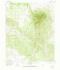
1959 Map of Riley
USGS Topo · Published 1961About this map
Riley sits along the Rio Salado in this central New Mexico landscape, a settlement characterized by its proximity to the massive bulk of Ladron Peak to the northeast. The 1950s terrain reveals a legacy of ranching and land grants, including the Sevilleta Grant Boundary and the Gray and Ligon Ranch. Much of the western portion of the map is dominated by the Cibola National Forest, where drainages like Bear Springs Canyon carve through the high ground. A network of primitive transport, including the Popotosa Jeep Trail, connects various points of interest such as Silver Creek Camp and several unnamed prospects. This survey illustrates the transition from mid-century ranching operations to the management of public forest lands, anchored by prominent landmarks like Monte Negro and the narrow passage known as The Box.
Find a feature on this map
28 named features on this map. Tap any name to fly to it.
Don’t see what you’re looking for? This feature index may not catch every label — zoom into the map to look around manually.
Map Details
Editions of this 1959 Riley Map
2 editions found
Other maps of this area

1906 · Socorro
USGS Topo · 1:62,500

1916 · La Joya
USGS Topo · 1:125,000

1917 · Cerro Verde
USGS Topo · 1:125,000

1952 · La Joya NW
USGS Topo · 1:24,000

1952 · San Anacia
USGS Topo · 1:24,000

1952 · Belen SW
USGS Topo · 1:24,000

1954 · Socorro
USGS Topo · 1:250,000

1956 · Mesa Aparejo
USGS Topo · 1:62,500

1958 · Socorro
USGS Topo · 1:250,000

1959 · Lemitar
USGS Topo · 1:24,000