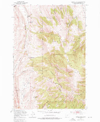
1951 Map of Rimrock Divide
USGS Topo · Published 1976About this map
The Crazy Mountains dominate the landscape of this mid-century survey, where the Lewis and Clark National Forest and Gallatin National Forest meet. The high-altitude terrain is marked by the Rimrock Divide and prominent ridges such as Bald Ridge and The Reefs. This era of documentation captures a transitional moment in high-country land use, as several isolated family sites are marked as abandoned, including the McKee Homestead, Hoyem Homestead, and Bill Bracket Place.
Find a feature on this map
41 named features on this map. Tap any name to fly to it.
Don’t see what you’re looking for? This feature index may not catch every label — zoom into the map to look around manually.
Map Details
Editions of this 1951 Rimrock Divide Map
2 editions found
Other maps of this area

1886 · Little Belt Mts.
USGS Topo · 1:250,000

1894 · Little Belt Mts.
USGS Topo · 1:250,000

1897 · Little Belt Mts.
USGS Topo · 1:250,000

1898 · Little Belt Mts.
USGS Topo · 1:250,000

1902 · Little Belt Mts.
USGS Topo · 1:250,000

1948 · White Sulphur Springs
USGS Topo · 1:250,000

1951 · Hamen
USGS Topo · 1:24,000
1951 · Wolf Hill
USGS Topo · 1:24,000

1951 · Rimrock Divide
USGS Topo · 1:24,000

1958 · White Sulphur Springs
USGS Topo · 1:250,000