
1967 Map of Rimrock Lake
USGS Topo · Published 1969About this map
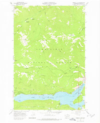
The North Fork Rimrock Lake and the engineered waters behind the Tieton Dam dominate this section of the Snoqualmie National Forest. In the late 1960s, the small settlement of Rimrock served as a hub for the irrigation and power infrastructure of the Yakima Valley, situated near the Tieton River and Crane Park. The map reveals a landscape managed for both utility and recreation, featuring the Tieton Emergency Airstrip and the Indian Creek Campground along the shoreline.
Find a feature on this map
43 named features on this map. Tap any name to fly to it.
Don’t see what you’re looking for? This feature index may not catch every label — zoom into the map to look around manually.
Map Details
Editions of this 1967 Rimrock Lake Map
Other maps of this area

1902 · Mount Aix
USGS Topo · 1:125,000

1904 · Mt Aix
USGS Topo · 1:125,000

1950 · Yakima
USGS Topo · 1:250,000

1958 · Yakima
USGS Topo · 1:250,000

1961 · Yakima
USGS Topo · 1:250,000

1962 · Bumping Lake
USGS Topo · 1:62,500

1962 · White Pass
USGS Topo · 1:62,500

1967 · Tieton Basin
USGS Topo · 1:24,000

1967 · Darland Mtn
USGS Topo · 1:24,000
1967 · Foundation Ridge
USGS Topo · 1:24,000