Loading...
Loading map...1950 Map of Rincon NO
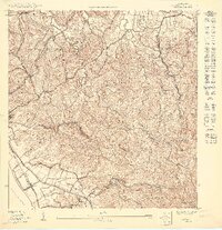
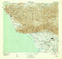
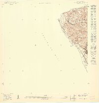
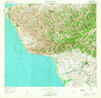
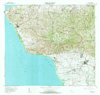
USGS Topo · Published 1950This historical map portrays the area of Rincon NO in 1950, primarily covering Rincón Municipio as well as portions of Aguada Municipio. Featuring a scale of 1:10000, this map provides a highly detailed snapshot of the terrain, roads, buildings, counties, and historical landmarks in the Rincon NO region at the time. Published in 1950, it is the sole known edition of this map.
Map Details
Date Portrayed1950
Date Published1950
PublisherU.S. Geological Survey
Map TypeTopographic
Scale1:10000
Physical Dimensions30.59 x 31.66 inches
Editions of this 1950 Rincon NO Map
This is the sole edition of this map. No revisions or reprints were ever made.
Historical Maps of Sector Rito Ríos Through Time
9 maps found


Featured Locations
- Bajío, Aguada
- Sector Rito Ríos, Aguada
- Sector Ruiz, Aguada
- Urbanización Las Casonas, Aguada
- Villas del Palmar, Aguada
Source Details
SourceU.S. Geological Survey
CopyrightPublic Domain