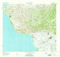
1966 Map of Rincon
USGS Topo · Published 1969About this map
The westernmost point of Puerto Rico is dominated by the strategic coastal landscape of Rincón, where the island meets the Mona Passage. This mid-1960s survey reveals a complex mix of agricultural tradition and emerging modern infrastructure, ranging from the sugar processing at Central Igualdad to the presence of a Planta Nuclear near Pta Higüero. The rugged interior is densely peppered with neighborhood schools like Escuela Rural Maestra Gándara and numerous religious landmarks, including the Capilla La Virgen de Monserrate. Transportation routes are well-defined, showing the Ferrocarril de Puerto Rico line tracking the southern coastline toward the Aeropuerto de Mayagüez. The map captures the transition of the shoreline, featuring recreational spots like the Balneario alongside established estates such as Hacienda Eugenia, providing a clear view of the region's social and economic geography before later-century development.
Find a feature on this map
145 named features on this map. Tap any name to fly to it.
Don’t see what you’re looking for? This feature index may not catch every label — zoom into the map to look around manually.
Map Details
Editions of this 1966 Rincon Map
2 editions found
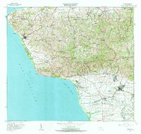
Other maps of this area

1937 · Aguadilla
USGS Topo · 1:20,000

1937 · Moca
USGS Topo · 1:20,000

1938 · Alto Sano
USGS Topo · 1:20,000

1939 · Mayaguez
USGS Topo · 1:30,000

1941 · Moca
USGS Topo · 1:30,000

1941 · Rincon
USGS Topo · 1:30,000

1941 · Rincon
USGS Topo · 1:30,000

1941 · Rosario
USGS Topo · 1:30,000

1942 · Moca
USGS Topo · 1:30,000

1942 · Central La Plata
USGS Topo · 1:30,000