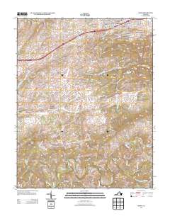
2013 Map of Riner
USGS Topo · Published 2013About this map
Riner serves as the central hub for this portion of Montgomery County, where the landscape transitions from residential subdivisions in the north to agricultural and riparian corridors in the south. The northern section is defined by a cluster of mid-to-late century developments such as Highview Terrace, Shadeland Addition, and Atkinson Acres, reflecting suburban growth near the Interstate 81 corridor. This development contrasts with the more rural southern reaches where the Little River meanders toward Sowers. Genealogists and local historians can find significant river crossings and landmarks including Broad Shoals Ford, Scaggs Ford, and the Altizer Bridge. The presence of Camp Carysbrook along the river and various family-named features like Calfee Knob and Poorhouse Knob illustrate the long-standing community ties and topographic heritage of the Blue Ridge plateau region.
Find a feature on this map
57 named features on this map. Tap any name to fly to it.
Don’t see what you’re looking for? This feature index may not catch every label — zoom into the map to look around manually.
Map Details
Editions of this 2013 Riner Map
This is the sole edition of this map. No revisions or reprints were ever made.
Other maps of this area

1889 · Hillsville
USGS Topo · 1:125,000

1890 · Dublin
USGS Topo · 1:125,000

1890 · Christiansburg
USGS Topo · 1:125,000

1891 · Dublin
USGS Topo · 1:125,000

1892 · Hillsville
USGS Topo · 1:125,000

1896 · Hillsville
USGS Topo · 1:125,000

1932 · Blacksburg
USGS Topo · 1:48,000

1937 · Blacksburg
USGS Topo · 1:62,500

1950 · Radford
USGS Topo · 1:62,500

1953 · Winston-Salem
USGS Topo · 1:250,000