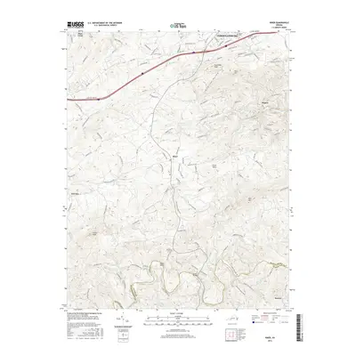
2016 Map of Riner
USGS Topo · Published 2016About this map
Christiansburg anchors the northern edge of this terrain where Interstate 81 and Mud Pike cut through the highlands of Montgomery County. Moving south, the landscape transitions into a network of rural communities such as Riner and Union Valley, defined by the winding paths of Meadow Creek and Mill Creek. The southern reaches of the map are particularly striking, where the Little River carves through the topography near Broad Shoals and the Montgomery and Floyd County border. Genealogists and local historians can find several significant burial and landmark sites, including Sunset Cemetery near the city and the Altizer Bridge crossing the river. The high points of Pilot Mountain and Calfee Knob provide a clear sense of the verticality that shaped early road placements like Old Rough Road and Seven Mile Tree Road.
Find a feature on this map
119 named features on this map. Tap any name to fly to it.
Don’t see what you’re looking for? This feature index may not catch every label — zoom into the map to look around manually.
Map Details
Editions of this 2016 Riner Map
This is the sole edition of this map. No revisions or reprints were ever made.
Other maps of this area

1889 · Hillsville
USGS Topo · 1:125,000

1890 · Dublin
USGS Topo · 1:125,000

1890 · Christiansburg
USGS Topo · 1:125,000

1891 · Dublin
USGS Topo · 1:125,000

1892 · Hillsville
USGS Topo · 1:125,000

1896 · Hillsville
USGS Topo · 1:125,000

1932 · Blacksburg
USGS Topo · 1:48,000

1937 · Blacksburg
USGS Topo · 1:62,500

1950 · Radford
USGS Topo · 1:62,500

1953 · Winston-Salem
USGS Topo · 1:250,000