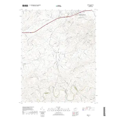
2019 Map of Riner
USGS Topo · Published 2019About this map
Christiansburg occupies the northern edge of this terrain, where modern development meets the rolling uplands of the Blue Ridge. South of the corporate limits, the landscape transitions into a series of smaller farming and residential clusters such as Rose Hill, Rogers, and the village of Riner. The survey captures a high-resolution view of the local drainage patterns that define this part of the Virginia highlands, including Meadow Cr and the winding course of Smith Cr. In the southern reaches, the Little River carves a deep, serpentine path through the hills near the Montgomery and Floyd county line.
Find a feature on this map
135 named features on this map. Tap any name to fly to it.
Don’t see what you’re looking for? This feature index may not catch every label — zoom into the map to look around manually.
Map Details
Editions of this 2019 Riner Map
This is the sole edition of this map. No revisions or reprints were ever made.
Other maps of this area

1889 · Hillsville
USGS Topo · 1:125,000

1890 · Dublin
USGS Topo · 1:125,000

1890 · Christiansburg
USGS Topo · 1:125,000

1891 · Dublin
USGS Topo · 1:125,000

1892 · Hillsville
USGS Topo · 1:125,000

1896 · Hillsville
USGS Topo · 1:125,000

1932 · Blacksburg
USGS Topo · 1:48,000

1937 · Blacksburg
USGS Topo · 1:62,500

1950 · Radford
USGS Topo · 1:62,500

1953 · Winston-Salem
USGS Topo · 1:250,000