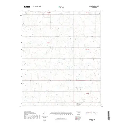
2018 Map of Ringling NW
USGS Topo · Published 2018About this map
Mud Cr and its tributaries, including Crooked Cr and Negro Cr, define the drainage patterns of this rural Jefferson County landscape. The area is marked by a network of local roads and family-named thoroughfares, suggesting a deeply rooted ranching or agricultural community. Long-established holdings are reflected in road names such as Dillard Tripp Wilson Rd, Ted Tripp Blvd, J R Ogle Blvd, and Murphy Ranch Rd. These named routes, along with Mountain Home Blvd, trace the section lines across township boundaries including t4s r5w and t4s r4w. In the southern reaches, Post Oak Cr meanders through the terrain near E1990 Rd, illustrating the characteristic creek-fed prairie environment of southern Oklahoma.
Find a feature on this map
35 named features on this map. Tap any name to fly to it.
Don’t see what you’re looking for? This feature index may not catch every label — zoom into the map to look around manually.
Map Details
Editions of this 2018 Ringling NW Map
This is the sole edition of this map. No revisions or reprints were ever made.
Other maps of this area

1901 · Addington
USGS Topo · 1:125,000

1957 · Ardmore
USGS Topo · 1:250,000

1962 · Ryan
USGS Topo · 1:62,500

1963 · Ardmore
USGS Topo · 1:250,000

1964 · Comanche SE
USGS Topo · 1:24,000
1974 · Orr
USGS Topo · 1:24,000

1974 · Ringling NW
USGS Topo · 1:24,000

1974 · Loco
USGS Topo · 1:24,000
1974 · Cottonwood Creek
USGS Topo · 1:24,000
1974 · Ringling
USGS Topo · 1:24,000