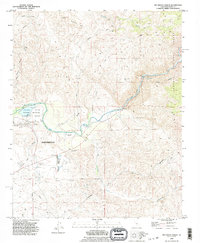
1992 Map of Rio Bravo Ranch
USGS Topo · Published 1995About this map
The Kern River carves through the landscape northeast of Bakersfield, where the valley floor meets the rising elevations of the Sequoia National Forest. This 1990s revision reveals a landscape defined by water management and resource extraction, featuring the recreational waters of Lake Ming within Kern County Park and the industrial footprint of numerous Oil Wells and a sprawling Oil Field.
Find a feature on this map
21 named features on this map. Tap any name to fly to it.
Don’t see what you’re looking for? This feature index may not catch every label — zoom into the map to look around manually.
Map Details
Editions of this 1992 Rio Bravo Ranch Map
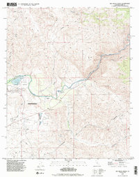
2 editions found
Other maps of this area

1906 · Bakersfield
USGS Topo · 1:62,500

1914 · Caliente
USGS Topo · 1:125,000

1920 · Delonagha
USGS Topo · 1:62,500

1926 · Glennville
USGS Topo · 1:62,500

1929 · Bena
USGS Topo · 1:31,680

1929 · Fairfax School
USGS Topo · 1:31,680

1931 · Edison
USGS Topo · 1:31,680

1932 · Bena
USGS Topo · 1:31,680

1932 · Fairfax School
USGS Topo · 1:31,680

1932 · Woody
USGS Topo · 1:62,500