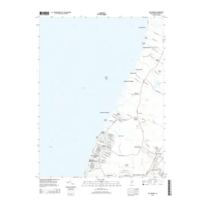
2014 Map of Rio Grande
USGS Topo · Published 2014About this map
The western shoreline of the Cape May peninsula meets Delaware Bay in this 2014 survey, revealing a landscape defined by small coastal hamlets and tidal marsh systems. A string of bayfront settlements, including Reeds Beach, Cooks Beach, and Kimbles Beach, sit at the ends of narrow access roads, while further south, more developed residential grids appear at Del Haven and Miami Beach. Inland, the commercial hub of Rio Grande is visible near the intersection of RT-47 and Shunpike RD, serving as a gateway to the broader coastal region.
Find a feature on this map
125 named features on this map. Tap any name to fly to it.
Don’t see what you’re looking for? This feature index may not catch every label — zoom into the map to look around manually.
Map Details
Editions of this 2014 Rio Grande Map
This is the sole edition of this map. No revisions or reprints were ever made.
Other maps of this area

1888 · Cape May
USGS Topo · 1:62,500

1888 · Dennisville
USGS Topo · 1:62,500

1890 · Maurice Cove
USGS Topo · 1:62,500

1891 · Maurice Cove
USGS Topo · 1:62,500

1893 · Cape May
USGS Topo · 1:62,500

1894 · Dennisville
USGS Topo · 1:62,500

1898 · Cape May
USGS Topo · 1:62,500

1899 · Vineland
USGS Topo · 1:125,000

1918 · Cape Henlopen
USGS Topo · 1:62,500

1918 · Cape May
USGS Topo · 1:62,500
Featured Places
- Lower Township, NJ
- Middle Township, NJ
- Villas, Lower Township
- Erma Park, Lower Township
- Norburys Landing, Middle Township