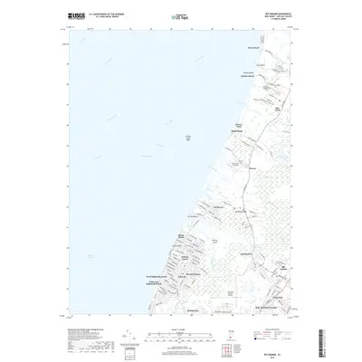
2019 Map of Rio Grande
USGS Topo · Published 2019About this map
Villas and the bayshore communities of Lower Township occupy the western edge of this coastal survey, where the street grids of Miami Beach and North Highlands Beach meet the edge of the Delaware Bay. The landscape is defined by the transition from densely packed residential blocks to the sprawling marshlands of the Fishing Creek area and the tidal inlets of Dias Creek. Inland, the economy and infrastructure are anchored by the Cape May County Airport and the commercial hub of Rio Grande, while smaller historic settlements like Nummytown and Sally Marshall Crossing preserve the memory of older crossroads. The map also highlights the ecological complexity of the peninsula, from the Fishing Creek Shoal along the coast to the interior Pennsylvania Ponds and the forested expanse of Hickory Island, illustrating how modern development must navigate the area's extensive network of creeks and wetlands.
Find a feature on this map
121 named features on this map. Tap any name to fly to it.
Don’t see what you’re looking for? This feature index may not catch every label — zoom into the map to look around manually.
Map Details
Editions of this 2019 Rio Grande Map
This is the sole edition of this map. No revisions or reprints were ever made.
Other maps of this area

1888 · Cape May
USGS Topo · 1:62,500

1888 · Dennisville
USGS Topo · 1:62,500

1890 · Maurice Cove
USGS Topo · 1:62,500

1891 · Maurice Cove
USGS Topo · 1:62,500

1893 · Cape May
USGS Topo · 1:62,500

1894 · Dennisville
USGS Topo · 1:62,500

1898 · Cape May
USGS Topo · 1:62,500

1899 · Vineland
USGS Topo · 1:125,000

1918 · Cape Henlopen
USGS Topo · 1:62,500

1918 · Cape May
USGS Topo · 1:62,500
Featured Places
- Lower Township, NJ
- Middle Township, NJ
- Villas, Lower Township
- Erma Park, Lower Township
- Norburys Landing, Middle Township