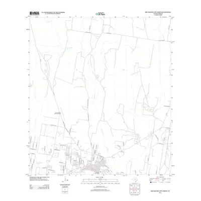
2012 Map of Rio Grande City North
USGS Topo · Published 2012About this map
Fort Ringgold Historic District anchors the southern edge of this Starr County landscape, marking a site of deep historical significance near the Rio Grande. The 2012 geography shows the urban expansion of Rio Grande City pushing northward, with residential streets such as E San Benito St and N Flores St forming a dense grid. Transportation and infrastructure are central to the area's layout, dominated by the Rio Grande City Municipal Airport and a network of rural roads that transition from city pavement to ranch access, including Old Charco Blanco Rd and La Sagunada Rd. The arid terrain is defined by the winding course of Los Olmos Cr, which meanders across the quadrangle, while Kelsey Lake provides a rare perennial water feature in the southwest. Named ranch sites like El Conejo Rnch reflect the enduring legacy of South Texas land use.
Find a feature on this map
63 named features on this map. Tap any name to fly to it.
Don’t see what you’re looking for? This feature index may not catch every label — zoom into the map to look around manually.
Map Details
Editions of this 2012 Rio Grande City North Map
This is the sole edition of this map. No revisions or reprints were ever made.
Other maps of this area

1938 · El Sauz
USGS Topo · 1:62,500

1938 · Sal Colorada
USGS Topo · 1:62,500

1949 · Mc Allen
USGS Topo · 1:250,000

1954 · McAllen
USGS Topo · 1:250,000

1956 · Garcias
USGS Topo · 1:62,500

1956 · Escobares
USGS Topo · 1:62,500

1957 · Mc Allen
USGS Topo · 1:250,000

1962 · McAllen
USGS Topo · 1:250,000

1965 · Rio Grande City South
USGS Topo · 1:24,000

1965 · Los Garzas
USGS Topo · 1:24,000
Featured Places
- Rio Grande City, TX
- A T Martinez Colonia, TX
- El Mesquite Colonia, TX
- El Rancho Vela Colonia, TX
- Bella Vista Colonia, TX