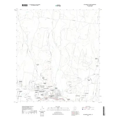
2019 Map of Rio Grande City North
USGS Topo · Published 2019About this map
Rio Grande City and its dense network of colonias anchor this 2019 survey of Starr County, Texas. The landscape is defined by a distinct transition from the concentrated residential clusters of Los Olmos Colonia, Canales Colonia, and Live Oak Estates Colonia in the south toward the more open, ranching-oriented terrain to the north. These named colonias, including Trevinos Number 1 Colonia and Francisca Colonia, reflect the unique settlement patterns of the border region, where family-linked communities have developed along the tributaries of Los Olmos Creek.
Find a feature on this map
114 named features on this map. Tap any name to fly to it.
Don’t see what you’re looking for? This feature index may not catch every label — zoom into the map to look around manually.
Map Details
Editions of this 2019 Rio Grande City North Map
This is the sole edition of this map. No revisions or reprints were ever made.
Other maps of this area

1938 · El Sauz
USGS Topo · 1:62,500

1938 · Sal Colorada
USGS Topo · 1:62,500

1949 · Mc Allen
USGS Topo · 1:250,000

1954 · McAllen
USGS Topo · 1:250,000

1956 · Garcias
USGS Topo · 1:62,500

1956 · Escobares
USGS Topo · 1:62,500

1957 · Mc Allen
USGS Topo · 1:250,000

1962 · McAllen
USGS Topo · 1:250,000

1965 · Rio Grande City South
USGS Topo · 1:24,000

1965 · Los Garzas
USGS Topo · 1:24,000
Featured Places
- Rio Grande City, TX
- A T Martinez Colonia, TX
- El Mesquite Colonia, TX
- El Rancho Vela Colonia, TX
- Bella Vista Colonia, TX