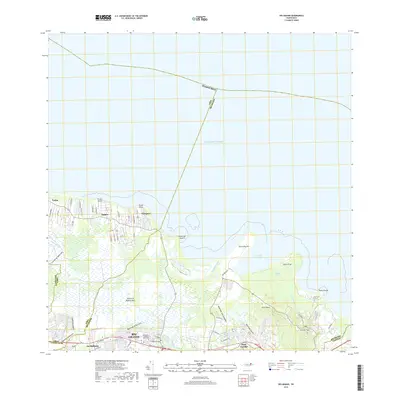
2018 Map of Rio Grande
USGS Topo · Published 2018About this map
The coastal wetlands and river mouths of northeast Puerto Rico define this topographic survey, where the Río Espíritu Santo and Río Grande de Espíritu Santo meet the Atlantic Ocean. The settlement of Río Grande sits at the southern edge of the sheet, served by the Cementerio Municipal Río Grande and the thoroughfare of Ave John Bain. Northward toward the coast, smaller communities like Suárez, Vieques, and Loíza are established near the shoreline and its numerous geographic points.
Find a feature on this map
34 named features on this map. Tap any name to fly to it.
Don’t see what you’re looking for? This feature index may not catch every label — zoom into the map to look around manually.
Map Details
Editions of this 2018 Rio Grande Map
This is the sole edition of this map. No revisions or reprints were ever made.
Other maps of this area

1940 · Carolina
USGS Topo · 1:30,000

1941 · Rio Grande
USGS Topo · 1:30,000

1941 · Carolina
USGS Topo · 1:30,000

1945 · El Yunque
USGS Topo · 1:30,000

1946 · El Yunque
USGS Topo · 1:30,000

1946 · Gurabo
USGS Topo · 1:30,000

1946 · Fajardo
USGS Topo · 1:30,000

1947 · Carolina
USGS Topo · 1:30,000

1947 · El Yunque NE
USGS Topo · 1:10,000

1947 · Gurabo NE
USGS Topo · 1:10,000