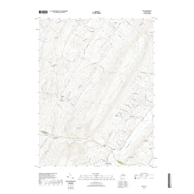
2019 Map of Rio
USGS Topo · Published 2019About this map
Rio and the surrounding river valleys of the West Virginia highlands appear here in detail, captured where the N River flows past the Hampshire and Hardy County border. The landscape is defined by its drainages and ridges, featuring the convergence of Waterlick Run, Deep Run, and Sperry Run near the Jerry Staggs Memorial Bridge. This 2019 survey provides a clear view of the rural infrastructure, from the small settlement at Rock Oak to the clustered cemeteries that serve the local community, such as the Bethel Baptist Church Cem and Lutheran Ebenezer Cem. The map traces the winding paths of Grassy Lick Road and Old Route 29, illustrating how topography dictates the movement and settlement patterns between Stony Mtn and North River Mtn. Genealogists and local historians can use these records to pinpoint family-named landmarks like Heare Cem and Raymond Hause Spring within this complex terrain.
Find a feature on this map
92 named features on this map. Tap any name to fly to it.
Don’t see what you’re looking for? This feature index may not catch every label — zoom into the map to look around manually.
Map Details
Editions of this 2019 Rio Map
This is the sole edition of this map. No revisions or reprints were ever made.
Other maps of this area

1891 · Romney
USGS Topo · 1:125,000

1920 · Moorefield
USGS Topo · 1:62,500

1920 · Keyser
USGS Topo · 1:62,500

1921 · Keyser
USGS Topo · 1:48,000

1921 · Hanging Rock
USGS Topo · 1:48,000

1921 · Moorefield
USGS Topo · 1:48,000

1922 · Moorefield
USGS Topo · 1:62,500

1922 · Wardensville
USGS Topo · 1:62,500

1922 · Keyser
USGS Topo · 1:62,500

1923 · Hanging Rock
USGS Topo · 1:62,500