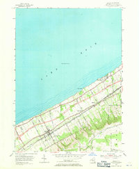
1954 Map of Ripley
USGS Topo · Published 1971About this map
Lake Erie defines the northern edge of this Chautauqua County landscape, where the shoreline is punctuated by small lakeside communities like Shore Haven and Ripley Beach. The map captures a significant moment in regional transportation history, documenting the Thruway under construction as it cuts through the vineyards and orchards of the lake plain. This modern infrastructure runs parallel to the long-established corridors of the New York Central and St Louis and the New York Chicago and St Louis railroads, which tie together the settlements of Ripley and Forsyth.
Find a feature on this map
34 named features on this map. Tap any name to fly to it.
Don’t see what you’re looking for? This feature index may not catch every label — zoom into the map to look around manually.
Map Details
Editions of this 1954 Ripley Map
2 editions found
Other maps of this area

1899 · Westfield
USGS Topo · 1:62,500

1905 · Clymer
USGS Topo · 1:62,500

1913 · North East
USGS Topo · 1:62,500

1915 · North East
USGS Topo · 1:62,500

1939 · Clymer
USGS Topo · 1:62,500

1941 · Clymer
USGS Topo · 1:62,500

1943 · North East
USGS Topo · 1:62,500

1954 · South Ripley
USGS Topo · 1:24,000

1954 · Ripley
USGS Topo · 1:24,000
1954 · Sherman
USGS Topo · 1:24,000