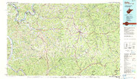
1984 Map of Ripley
USGS Topo · Published 1984About this map
The Ohio River valley forms a critical transportation and industrial corridor on this 1984 survey, where the Conrail line and State Highway 2 connect river towns like New Haven, Ravenswood, and Syracuse. The landscape transitions from these fertile bottomlands into the dissected plateaus of the West Virginia interior, characterized by prominent ridges like Jim Ridge and Egypt Ridge. This mid-1980s data reflects a period of extensive energy extraction, with vast Oil and Gas Fields and scattered Gas Fields spanning across Jackson, Roane, and Kanawha counties.
Find a feature on this map
164 named features on this map. Tap any name to fly to it.
Don’t see what you’re looking for? This feature index may not catch every label — zoom into the map to look around manually.
Map Details
Editions of this 1984 Ripley Map
This is the sole edition of this map. No revisions or reprints were ever made.
Other maps of this area

1889 · Nicholas
USGS Topo · 1:125,000

1891 · Nicholas
USGS Topo · 1:125,000

1892 · Huntington
USGS Topo · 1:125,000

1893 · Sutton
USGS Topo · 1:125,000

1897 · Kanawha Falls
USGS Topo · 1:125,000

1898 · Huntington
USGS Topo · 1:125,000

1899 · Charleston
USGS Topo · 1:125,000

1900 · Kanawha Falls
USGS Topo · 1:125,000

1901 · Nicholas
USGS Topo · 1:125,000

1901 · Kanawha Falls
USGS Topo · 1:125,000