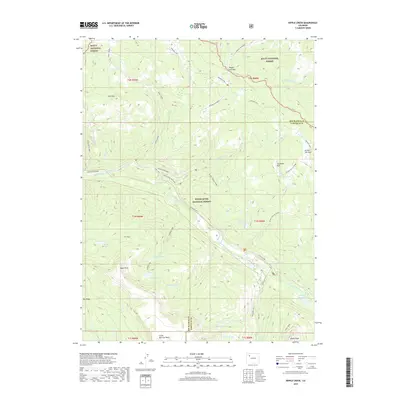
2019 Map of Ripple Creek
USGS Topo · Published 2019About this map
Ripple Creek Pass serves as a central focal point in this high-altitude landscape where the Routt National Forest and White River National Forest meet. The geography is defined by prominent basaltic features like the Chinese Wall and sharp elevation changes at Himes Peak and Snell Mtn. This area is a significant hydrological headwaters region, feeding the N Fork White River through a complex system of alpine lakes including Mirror Lake, Rainbow Lake, and Boulder Lake. The road and trail network, featuring routes such as the Marvine-Phippsburg and the Ripple Creek Dump Road, reflects a landscape managed for both timber and recreation. Local identifiers like Picket Pin Park and Big Ridge illustrate how landform names provided essential orientation for early foresters and travelers navigating the divide between Rio Blanco and Garfield counties.
Find a feature on this map
55 named features on this map. Tap any name to fly to it.
Don’t see what you’re looking for? This feature index may not catch every label — zoom into the map to look around manually.
Map Details
Editions of this 2019 Ripple Creek Map
This is the sole edition of this map. No revisions or reprints were ever made.
Other maps of this area

1927 · Glenwood Springs
USGS Topo · 1:125,000

1930 · Glenwood Springs
USGS Topo · 1:125,000

1954 · Craig
USGS Topo · 1:250,000

1957 · Craig
USGS Topo · 1:250,000

1957 · Leadville
USGS Topo · 1:250,000

1958 · Craig
USGS Topo · 1:250,000

1959 · Leadville
USGS Topo · 1:250,000

1960 · Leadville
USGS Topo · 1:250,000

1960 · Craig
USGS Topo · 1:250,000

1962 · Leadville
USGS Topo · 1:250,000