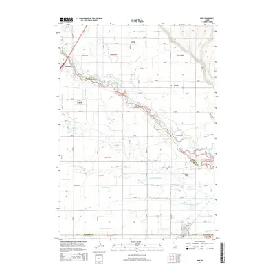
2017 Map of Ririe
USGS Topo · Published 2017About this map
Ririe anchor the southeastern corner of this Snake River Valley landscape, where an intricate network of irrigation canals and natural sloughs defines the agricultural economy. The Snake River winds diagonally across the quadrangle, flanked by numerous diversions including the Burgess Canal, Enterprise Canal, and Farmers Friend Canal. These waterworks reflect a century of engineering designed to reclaim the fertile soil of the Upper Snake River Plain. Small settlements like Lorenzo, Lyman, and Archer are connected by a precise grid of county roads, while the Sutton Cem near Archer provides a touchstone for local genealogical research. North of Ririe, the Butler Island landform sits surrounded by the Dry Bed and Lowder Slough, illustrating the braided nature of the river system before it reaches the larger diversions near Labelle.
Find a feature on this map
128 named features on this map. Tap any name to fly to it.
Don’t see what you’re looking for? This feature index may not catch every label — zoom into the map to look around manually.
Map Details
Editions of this 2017 Ririe Map
This is the sole edition of this map. No revisions or reprints were ever made.
Other maps of this area

1948 · Rigby
USGS Topo · 1:24,000

1948 · Ucon
USGS Topo · 1:24,000

1949 · Ucon
USGS Topo · 1:24,000

1949 · Rexburg
USGS Topo · 1:24,000

1949 · Rigby
USGS Topo · 1:24,000

1950 · Ririe
USGS Topo · 1:24,000

1950 · Rexburg
USGS Topo · 1:24,000

1950 · Rigby
USGS Topo · 1:62,500

1950 · Rigby SE
USGS Topo · 1:24,000

1951 · Rigby SE
USGS Topo · 1:24,000