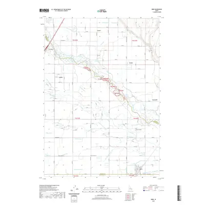
2020 Map of Ririe
USGS Topo · Published 2020About this map
The Snake River carves a diagonal path through this agricultural landscape, where an intricate web of irrigation defines the local economy and settlement patterns. The town of Ririe anchors the southeastern corner near the Enterprise Canal, while smaller communities like Lyman, Archer, and Sunnydell are scattered across the plains. A complex system of waterways, including the Liberty Park Canal, Clark Edwards Canal, and the Reid Canal, demonstrates the heavy reliance on water management for the region's farms. Notable for genealogists, the Sutton Cem is situated near the northern reach of the river. The map also captures several distinct sloughs and secondary channels, such as Spring Slough and Texas Slough, which branch from the main river corridor near Lorenzo. This network of ditches and canals, like the Farmers Friend Canal and Sidehill Ditch, illustrates the engineering required to sustain these communities.
Find a feature on this map
82 named features on this map. Tap any name to fly to it.
Don’t see what you’re looking for? This feature index may not catch every label — zoom into the map to look around manually.
Map Details
Editions of this 2020 Ririe Map
This is the sole edition of this map. No revisions or reprints were ever made.
Other maps of this area

1948 · Rigby
USGS Topo · 1:24,000

1948 · Ucon
USGS Topo · 1:24,000

1949 · Ucon
USGS Topo · 1:24,000

1949 · Rexburg
USGS Topo · 1:24,000

1949 · Rigby
USGS Topo · 1:24,000

1950 · Ririe
USGS Topo · 1:24,000

1950 · Rexburg
USGS Topo · 1:24,000

1950 · Rigby
USGS Topo · 1:62,500

1950 · Rigby SE
USGS Topo · 1:24,000

1951 · Rigby SE
USGS Topo · 1:24,000