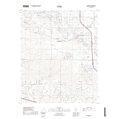
2018 Map of Ritter Ridge
USGS Topo · Published 2018About this map
The San Andreas Fault cuts a definitive line through the center of this landscape, separating the high desert floor of Palmdale from the elevated mountain terrain of the Sierra Pelona. To the north, the Governor Edmund G Brown East Branch California Aqueduct snakes along the base of Portal Ridge and Ritter Ridge, illustrating the massive infrastructure required to support the residential expansion of Desert View Highlands. The geography is defined by a series of parallel valleys and canyons, including the Leona Valley and Anaverde Valley, which follow the tectonic orientation of the region. This 2018 survey captures the dense street grid of southern Palmdale as it meets the natural obstacles of Ritter Canyon and Godde Pass, providing a detailed look at how modern development integrates with the complex geology of the Antelope Valley foothills.
Find a feature on this map
198 named features on this map. Tap any name to fly to it.
Don’t see what you’re looking for? This feature index may not catch every label — zoom into the map to look around manually.
Map Details
Editions of this 2018 Ritter Ridge Map
This is the sole edition of this map. No revisions or reprints were ever made.
Other maps of this area

1900 · Tujunga
USGS Topo · 1:62,500

1900 · Fernando
USGS Topo · 1:62,500

1901 · Southern California Sheet No. 1
USGS Topo · 1:250,000

1904 · Southern California Sheet No. 1
USGS Topo · 1:250,000

1915 · Elizabeth Lake
USGS Topo · 1:125,000

1917 · Elizabeth Lake
USGS Topo · 1:125,000

1930 · Ravenna
USGS Topo · 1:24,000

1930 · Lancaster
USGS Topo · 1:24,000

1931 · Del Sur
USGS Topo · 1:24,000

1932 · Red Rover
USGS Topo · 1:24,000