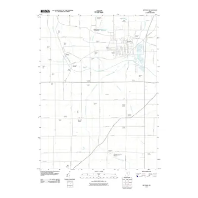
2010 Map of Rittman
USGS Topo · Published 2010About this map
Rittman serves as the primary municipal center in this Northeast Ohio landscape, where industrial development and residential streets meet the agricultural flatlands of Wayne and Medina Counties. The northern boundary is defined by the Ohio Western Reserve National Cemetery, while the surrounding countryside is dotted with legacy farmsteads such as Fountain Spring Farm and Bauman Orchards. The area reflects a diverse religious heritage, evidenced by numerous burial grounds including the Crown Hill Mennonite Cemetery and Old Dunkard Cemetery. Hydrology plays a central role in the terrain, with Chippewa Creek and the Styx River winding through the quadrangle, managed in part by the Chippewa Conservation District Structure VII C Dam. Smaller crossroads like Johnsons Corners and Sterling anchor the rural sections of the map, connected by a network of local roads including Pleasant Home Rd and Fox Lake Rd.
Find a feature on this map
89 named features on this map. Tap any name to fly to it.
Don’t see what you’re looking for? This feature index may not catch every label — zoom into the map to look around manually.
Map Details
Editions of this 2010 Rittman Map
This is the sole edition of this map. No revisions or reprints were ever made.
Other maps of this area

1901 · Massillon
USGS Topo · 1:62,500

1901 · Wooster
USGS Topo · 1:62,500

1903 · Massillon
USGS Topo · 1:62,500

1903 · Wooster
USGS Topo · 1:62,500

1903 · Akron
USGS Topo · 1:62,500

1904 · Medina
USGS Topo · 1:62,500

1905 · Akron
USGS Topo · 1:62,500

1906 · Medina
USGS Topo · 1:62,500

1950 · Cleveland
USGS Topo · 1:250,000

1951 · Canton
USGS Topo · 1:250,000