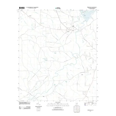
2011 Map of River Falls
USGS Topo · Published 2011About this map
The Conecuh River and Patsaliga Creek converge in this part of Covington County, defining a landscape shaped by water and timber resources. At the northern edge, Point A Dam holds back the waters of Point A Lake, a significant local landmark. The settlement of River Falls serves as a central hub, where the River Falls Post Office and River Falls Cemetery are situated near the crossing of the river. The road network, including Railroad Ave and Industrial Ave, suggests the town's historical connection to rail and local commerce.
Find a feature on this map
66 named features on this map. Tap any name to fly to it.
Don’t see what you’re looking for? This feature index may not catch every label — zoom into the map to look around manually.
Map Details
Editions of this 2011 River Falls Map
This is the sole edition of this map. No revisions or reprints were ever made.
Other maps of this area

1953 · Andalusia
USGS Topo · 1:250,000

1957 · Andalusia
USGS Topo · 1:250,000

1971 · Dixie
USGS Topo · 1:24,000

1971 · Brooks
USGS Topo · 1:24,000

1971 · Carolina
USGS Topo · 1:24,000

1971 · Libertyville
USGS Topo · 1:24,000

1971 · River Falls
USGS Topo · 1:24,000

1971 · Andalusia
USGS Topo · 1:24,000

1971 · Gantt
USGS Topo · 1:24,000

1971 · Red Level
USGS Topo · 1:24,000