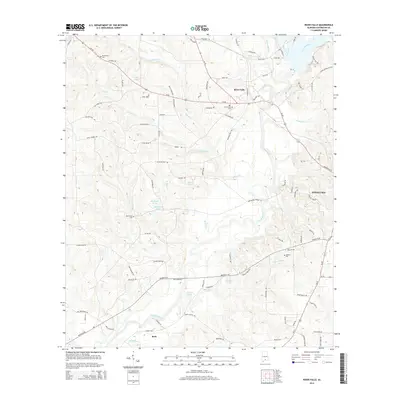
2014 Map of River Falls
USGS Topo · Published 2014About this map
The Conecuh River and Patsaliga Creek converge in this portion of Covington County, where the settlement of River Falls serves as a primary local junction. The landscape is defined by its water network, where numerous ponds like Blackmon Pond and Fuqua Pond dot the terrain alongside small tributaries such as Adams Cr and Fall Cr. The map captures the western outskirts of Andalusia, showing the city's expansion toward the river valley. For those tracing family histories, several local landmarks provide essential reference points, including Bethlehem Cem and Adellum Cem. The road system, dominated by Us-84, links smaller communities like Beck to the larger regional centers, following the natural contours of the river basin. This detailed record highlights the transition from suburban Andalusia to the more dispersed rural landscape of the Alabama coastal plain.
Find a feature on this map
103 named features on this map. Tap any name to fly to it.
Don’t see what you’re looking for? This feature index may not catch every label — zoom into the map to look around manually.
Map Details
Editions of this 2014 River Falls Map
This is the sole edition of this map. No revisions or reprints were ever made.
Other maps of this area

1953 · Andalusia
USGS Topo · 1:250,000

1957 · Andalusia
USGS Topo · 1:250,000

1971 · Dixie
USGS Topo · 1:24,000

1971 · Brooks
USGS Topo · 1:24,000

1971 · Carolina
USGS Topo · 1:24,000

1971 · Libertyville
USGS Topo · 1:24,000

1971 · River Falls
USGS Topo · 1:24,000

1971 · Andalusia
USGS Topo · 1:24,000

1971 · Gantt
USGS Topo · 1:24,000

1971 · Red Level
USGS Topo · 1:24,000