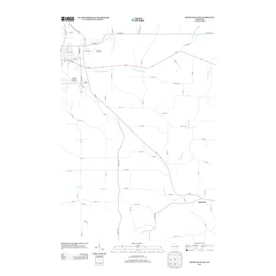
2013 Map of River Falls East
USGS Topo · Published 2013About this map
The S Fork Kinnickinnic River and its tributaries carve a distinct path through this Pierce County landscape, defining the rural character east of the city. While the western edge of the sheet transitions into the academic and recreational outskirts of town — marked by the University of Wisconsin - River Falls Farm Number 1 and the River Falls Golf Course — the remainder of the area remains largely agricultural. The small community of Beldenville sits near the confluence of Goose Cr and the Trimbelle River, serving as a focal point for the surrounding farmstead network. A dense grid of numbered roads, such as 830th Ave and 950th St, illustrates the systematic land division that has governed Wisconsin's dairy country for generations, with the winding Big River further south providing natural drainage for these rolling uplands.
Find a feature on this map
57 named features on this map. Tap any name to fly to it.
Don’t see what you’re looking for? This feature index may not catch every label — zoom into the map to look around manually.
Map Details
Editions of this 2013 River Falls East Map
This is the sole edition of this map. No revisions or reprints were ever made.
Other maps of this area

1940 · Maiden Rock
USGS Topo · 1:62,500

1944 · Red Wing
USGS Topo · 1:62,500

1946 · River Falls
USGS Topo · 1:62,500

1949 · River Falls
USGS Topo · 1:62,500

1949 · Baldwin
USGS Topo · 1:62,500

1950 · Maiden Rock
USGS Topo · 1:62,500

1952 · Red Wing
USGS Topo · 1:62,500

1953 · Saint Paul
USGS Topo · 1:250,000

1959 · Saint Paul
USGS Topo · 1:250,000
1974 · River Falls East
USGS Topo · 1:24,000