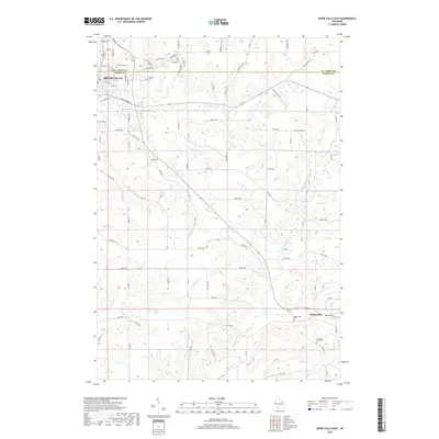
2018 Map of River Falls East
USGS Topo · Published 2018About this map
River Falls sits at the northwestern edge of this landscape, where residential expansion meets the agricultural plateaus of the Wisconsin countryside. The terrain is defined by the deep incisions of the S Fork Kinnickinnic River and the winding course of the Trimbelle River, which cuts through the central and southern sections of the map. This area preserves a high density of small rural burial grounds, including Greenwood Cem near the city and the more remote Thurston Hill Cem to the southeast. To the east, the settlement of Beldenville serves as a local hub near the banks of Goose Cr. The drainage patterns of the Big River and smaller tributaries illustrate the complex watershed that dictates the placement of long-standing county roads like Co Rd M and Co Hwy JJ.
Find a feature on this map
80 named features on this map. Tap any name to fly to it.
Don’t see what you’re looking for? This feature index may not catch every label — zoom into the map to look around manually.
Map Details
Editions of this 2018 River Falls East Map
This is the sole edition of this map. No revisions or reprints were ever made.
Other maps of this area

1940 · Maiden Rock
USGS Topo · 1:62,500

1944 · Red Wing
USGS Topo · 1:62,500

1946 · River Falls
USGS Topo · 1:62,500

1949 · River Falls
USGS Topo · 1:62,500

1949 · Baldwin
USGS Topo · 1:62,500

1950 · Maiden Rock
USGS Topo · 1:62,500

1952 · Red Wing
USGS Topo · 1:62,500

1953 · Saint Paul
USGS Topo · 1:250,000

1959 · Saint Paul
USGS Topo · 1:250,000
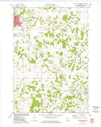
1974 · River Falls East
USGS Topo · 1:24,000